Aegean Sea Routes: How Ancient Greeks and Romans Crossed the Mediterranean
6 min read / 2026-06-23
Long before aeroplanes or motorways, the Aegean Sea was the main highway connecting Europe, Asia, and Africa. Learn how ancient sailors used islands as stepping stones to move people, goods, and ideas across the ancient world.
What it means
The Aegean Sea is a part of the Mediterranean Sea sitting between modern-day Greece and Turkey. It is dotted with hundreds of islands — large and small — that ancient sailors used as stopping points, much like how a traveller today uses bus stops or railway stations. These island stops were so important that entire trade networks, religions, and empires were built around them. When we talk about 'Aegean sea routes,' we mean the regular paths that ships followed from port to port across this busy stretch of water.
How it worked
Ancient ships were powered by oars and sails, so they depended heavily on wind direction and visibility. Sailors could rarely travel in a straight line across open sea — it was risky and slow. Instead, they hugged the coastline or hopped between islands, keeping land in sight as much as possible. Each island offered fresh water, food, shelter from storms, and a place to trade. The island of Samothraki, for example, sits roughly midway between the coast of what is now Turkey and the mainland of northern Greece (then called Macedonia), making it a natural overnight stop. This is exactly how the Apostle Paul's journey around 49–50 CE worked: he sailed from Asia Minor (modern Turkey), rested at Samothraki, then continued to the European mainland.
A simple example
Think of the Aegean islands like stepping stones across a stream. You wouldn't jump all the way across in one leap — you'd step on each stone one at a time. A merchant sailing from Alexandria in Egypt to Athens in Greece would follow a similar logic: stop at Rhodes, then Samos, then a smaller island, then the mainland. Each stop took a day or two depending on winds. Ancient Greek and Roman sailors had no GPS or weather apps, so they relied on knowledge passed down through generations, star positions at night, and the shape of coastlines to navigate.
Why people still talk about it
These ancient sea routes shaped much of world history. Trade goods like olive oil, grain, pottery, and cloth moved along them. So did languages, religions, scientific ideas, and art styles. The famous marble sculpture called the Winged Victory of Samothrace — now on display at the Louvre museum in Paris — was created around 190 BCE and placed on Samothraki, an island that sat on one of these busy routes. Pilgrims, merchants, soldiers, and philosophers all passed through the same waters. The routes also explain why so many ancient Greek islands have ruins of temples, ports, and markets: wherever ships stopped regularly, towns and sacred sites grew up.
What to remember
Geography is not just background scenery — it shapes what people do and where civilisations grow. The Aegean Sea's layout of islands turned the Mediterranean into a connected world rather than a barrier. Sea travel in ancient times was slow and weather-dependent, but it was far faster than crossing mountains or deserts on foot. Islands like Samothraki were not isolated backwaters; they were crucial links in a network that connected continents. Many heritage sites we visit or study today — temples, jetties, sculptures — exist because of the importance of these ancient sea crossings.
Key words
Aegean Sea
A part of the Mediterranean Sea between Greece and Turkey, containing hundreds of islands used as stopping points by ancient sailors.
Trireme
A type of ancient Greek warship powered by three rows of oarsmen on each side, also used for trade and transport.
Biosphere Reserve
An area recognised by UNESCO for protecting biodiversity while also allowing people to live and work there sustainably.
Asia Minor
The historical name for the large peninsula that makes up most of modern-day Turkey, a key region in ancient Greek and Roman times.
Key facts
- 1The Aegean Sea covers about 214,000 square kilometres and contains more than 1,400 islands, islets, and rocky outcrops.
- 2Ancient Greek trireme warships could cover roughly 150–200 kilometres per day under good wind conditions, using both oars and sails.
- 3The word 'Mediterranean' comes from the Latin words for 'middle' (medius) and 'land' (terra) — the Romans saw it as the sea at the centre of the known world.
- 4Samothraki reaches 1,611 metres at its highest peak — Mount Fengari — which ancient sailors used as a landmark to spot the island from far out at sea.
- 5The Apostle Paul's missionary journeys, recorded in the New Testament's Acts of the Apostles, covered an estimated 15,000–20,000 kilometres over land and sea across the Roman Empire.
Why it matters
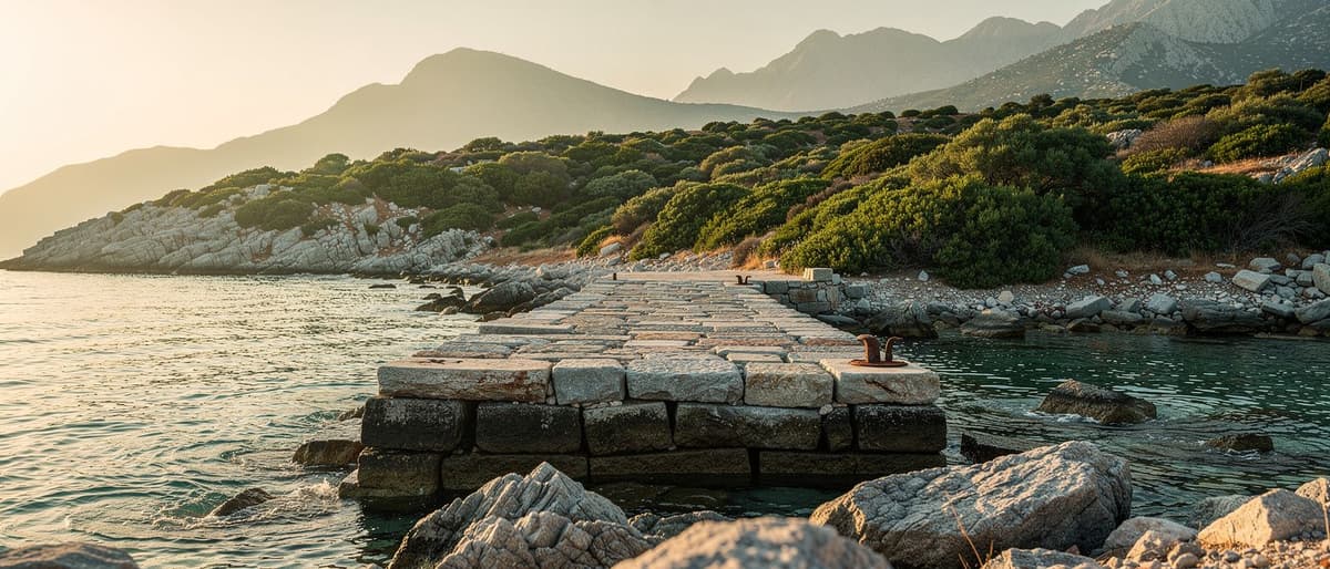
Understanding ancient sea routes explains why small islands became centres of religion, trade, and culture — and why heritage sites like St Paul's Jetty carry layers of history that are still visited today.
Sources
- Atlas Obscura — Samothraki Island Guide
- The Louvre Museum, Paris — Winged Victory of Samothrace collection notes
- UNESCO Biosphere Reserve Programme — Samothraki Reserve profile